Cape Cod Airfield offers a variety of services for pilots, fuel, maintenance, and tie downs (over night or long term).
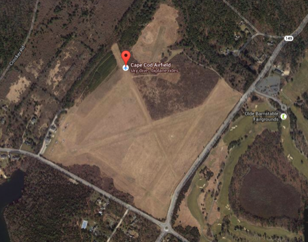
On the right is a Google map view of the airfield. You can link to a live Google map here.
See the complete and most recent pilot information from AirNav.com.
FAA INFORMATION EFFECTIVE 29 MAY 2024
Location
FAA Identifier: 2B1
Lat/Long:
41-41-07.0000N / 070-24-08.1000W
41-41.116667N / 070-24.135000W
41.6852778 / -70.4022500
(estimated)
Elevation: 103 ft. / 31 m (estimated)
Variation: 16W (1985)
From City: 5 miles SE of MARSTONS MILLS, MA
Time zone: UTC -4 (UTC -5 during Standard Time)
Zip Code: 02648
Airport Operations
Airport Use: Open to the public
Activation Date; 04/1940
Sectional chart: NEW YORK
Control Tower: No
ARTCC: Boston Center
FSS: Bridgeport Flight Service Station
NOTAM’s Facility: BDR (NOTAM-D service available)
Attendance: DAYLIGHT HOURS
Pattern Altitude: 803 ft. MSL
Wind indicator: yes
Segmented Circle: no
Airport Communications
CTAF: 122.9
WX ASOS at HYA (6 nm E): PHONE 508-862-2601
WX ASOS at CQX (18 nm E): 135.875 (508-945-5034)
WX ASOS at PYM (20 nm NW): 135.625 (508-746-8003)
WX ASOS at MVY (20 nm SW): PHONE 508-696-6988
• CLNC DLVY THRU BRIDGEPORT FSS (BDR) 1-866-293-5149.
Nearby radio navigation aids
VOR radial/distance VOR name Freq Var
MVYr044/19.8 MARTHAS VINEYARD VOR/DME 114.50 15W
LFVr235/25.7 MARCONI VOR/DME 114.70 16W
ACKr340/29.5 NANTUCKET VOR/DME 116.20 15W
NDB name Hdg/Dist Freq Var ID
BOMDE 163/3.33 362 15W FM ..-. --
NAUSET 285/18.5 279 16W CQX -.-. --.- -..-
PLYMOUTH 135/20.4 257 16W FFF ..-. ..-. ..-.
PROVINCETOWN 215/24.4 389 16W PVC .--. ...- -.-.
NANTUCKET 353/26.9 194 15W TUK - ..- -.-
MARSHFIELD 170/27.6 368 16W IMR .. -- .-.
TAUNTON 129/29.8 227 16W TAN - .- -.
Airport Services
Fuel Available: 100LL
Parking: hangars and tie downs
Airframe Service: MINOR
Powerplant Service: MINOR
Bottled Oxygen: NONE
Bulk Oxygen: NONE
Runway Information
Runway 9/27
Dimensions: 2700 x 60 ft. / 823 x 18 m
Surface: turf, in good condition
Runway 9
Latitude: 41-41.055555N
Longitude: 070-24.453857W
Elevation: 97.8 ft.
Gradient: 0.4%
Traffic pattern: left
Obstructions: 5 ft. trees, 24 ft. from runway, 75 ft. left of centerline, 9:1 slope to clear
Runway 27
Latitude: 41-41.178257N
Longitude: 070-23.937093W
Elevation: 95.3 ft.
Gradient: 0.4%
Traffic pattern: left
Obstructions: 30 ft. trees, 148 ft. from runway, 60 ft. right of centerline, 5:1 slope to clear
Runway 17/35
Dimensions: 2060 x 60 ft. / 628 x 18 m
Surface: turf, in good condition
Runway 17
Latitude: 41-41.268268N
Longitude: 070-24.233773W
Elevation: 102.8 ft.
Traffic pattern: left
Obstructions: 18 ft. trees, 72 ft. from runway, 60 ft. right of centerline, 4:1 slope to clear
Runway 35
Latitude: 41-41.003185N
Longitude: 070-24.062942W
Elevation: 89.1 ft.
Traffic Pattern: left
Obstructions: 9 ft. pline, 36 ft. from runway, 75 ft. right of centerline, 4:1 slope to clear
RY 35 ALSO HAS TREES
Runway 5/23
Dimensions: 2035 x 50 ft. / 620 x 15 m
Surface: turf, in good condition
Runway 5
Latitude: 41-40.968793N
Longitude: 070-24.154057W
Elevation: 91.0 ft.
Gradient: 0.6%
Traffic pattern: left
Obstructions: 13 ft. trees, 40 ft. from runway, 125 ft. both sides of centerline, 4:1 slope to clear
Runway 23
Latitude: 41-41.224140N
Longitude: 070-23.926715W
Elevation: 94.1 ft.
Gradient: 0.6%
Traffic pattern: left
Obstructions: 50 ft. trees, 200 ft. from runway, 125 ft. of centerline, 4:1 slope to clear
Ownership: Publicly-owned
Owner:
TOWN OF BARNSTABLE
367 MAIN STREET
HYANNIS, MA 02601
Phone 508-862-4000
Manager;
CHRISTOPHER SIDERWICZ
1000 RACE LANE
MARSTONS MILLS, MA 02648
Phone 508/428-8732
Airport Operational Statistics
Aircraft based on the field: 14
Single engine airplanes: 13
Multi engine airplanes: 1
Aircraft operations: avg 23/week*
85% local general aviation
15% transient general aviation
* for the 12-month period ending 01 April 2012
-
BE AWARE OF HI-SPEED MILITARY JET & HEAVY HELICOPTER TFC VCNTY OTIS AFB.
-
BE ALERT FOR RADIO CONTROL AIRPLANES NE CORNER AIRFIELD.
-
BANNER TOW OPS IN PROGRESS JUN THRU AUG NORTH SIDE OF AIRFIELD.
-
GLIDER TOW OPNS DURG DALGT HRS.
-
PPR REQUIRED FOR RY 05/23 OPERATIONS.
-
PARACHUTE JUMPING ON FLD.
Instrument Procedures
There are no published instrument procedures at 2B1.
Some nearby airports with instrument procedures:
KHYA - Barnstable Municipal Airport-Boardman/Polando Field (6 nm E)
KFMH - Cape Cod Coast Guard Air Station (6 nm W)
KCQX - Chatham Municipal Airport (18 nm E)
KPYM - Plymouth Municipal Airport (20 nm NW)
KMVY - Martha's Vineyard Airport (20 nm SW)
** Information above has been copied directly from the Air/Nav website, we are not liable for mistakes that might be made in the above information. For the most up-to-date and comprehensive information please visit the Air/Nav website.
Pilot information